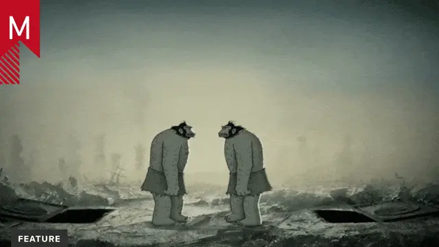
Revealing the Secrets of the Ocean Floor

The Royal Institution

Beautiful and informative animation by Rosanna Wan.

From the creator:

Continental drift is common knowledge now, but when the idea was first proposed it was revolutionary. Helen Czerski tells the story of how the maps of one of history’s finest cartographers shifted our view of the planet.

In the early 20th century, Alfred Wegener proposed a revolutionary idea: that the Earth’s continents were once joined together, and had gradually moved apart. The idea contradicted almost everything scientists thought at the time, and it took the detailed work of a brilliant cartographer to prove him right.
Conventional ideas held that the ocean floors were flat, featureless planes. As expeditions started to go around the world collecting ocean depth measurements, Marie Tharp – not allowed to join the expeditions herself – processed the data and began to craft detailed, revealing maps of the hidden ocean depths.

She discovered that the ocean floor was in fact a complex assortment of peaks and troughs. In particular, her profiles revealed stark rift valleys, which supported Wegener’s controversial ideas. Even then, it took a long time to convince the scientific community that her findings were correct. Eventually, however, she was proved right, and Marie Tharp took her rightful place as one of history’s finest cartographers.